Sunday, July 17, 2011

July 17th Mont Agel

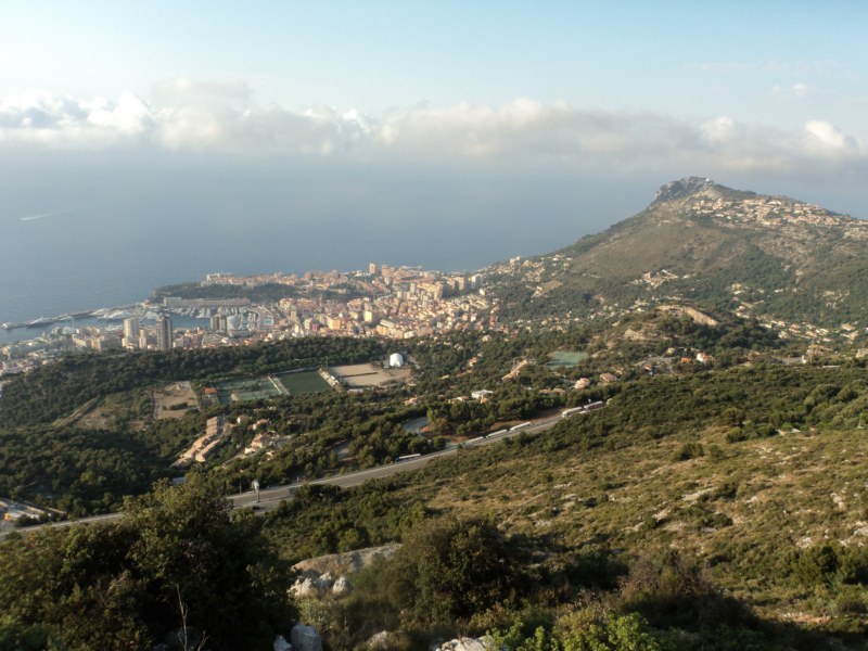
Mont Agel was shaping up as a tough climb - it has to be one of the highest points in the immediate vicinity of Nice. Atop the mountain is an Air Force base that tracks air traffic for Southeastern France.

The ride out is fantastic - one of my favorite routes as you go by Eze and continue on with steady climbing to La Turbie and then over the motorway tunnel and now onto the Route du Mont Agel.
The observatory in the distance below? Looks high up but soon I will be looking down on it!


Shortly after I get a treat by passing by the Monte Carlo Golf Club. This golf club is situated directly on the side of a mountain - pretty cool. It is very quiet early in the morning - no golfers and not a lot of cars. Shortly after passing by the golf club I am faced with a warning - restricted area - no cars allowed.

I figure I can press on and just turn around once I reach the top so off I go and now the road gets even better. Very steep with about 9 switchbacks. They are even labelled with numbered placards at each one! Great climb, just get passed by one car but when I get to the top I am greeted by a member of the French Air Force and told to descend. No idea what he was saying, the only word I caught was descend. No problem, I am happy to go and as I do I stop at some of the switchbacks to take in some views.


This was another fantastic ride, great switchbacks and quiet roads. The trip back through La Turbie and then the back way to Nice was awesome, but my time in Nice is running out.

Must be Nice!


The Mont Agel climb is the last 9k before the peak in the chart below
Stats: A Category 1 climb of 9km @6.5% topping out at 1150m

Saturday, July 16, 2011

July 16th San Remo & The Poggio

Today a big ride was planned - it was a Saturday and I was going to go to San Remo by Train and ride the last few kms including the Poggio of the famous Milan-San Remo race - one of the cycling monuments.
The plan was to take the train to San Remo and then ride back, but I decided to scrap the 2nd part of the train ride and do it by bike. I took the first train at 6.20 Saturday morning from Nice to Ventimiglia with my bike with no problems. Originally I thought I would then grab another train from Ventimiglia to San Remo but between the logistics of getting another ticket while in Italy and trying to figure out the schedule and then change trains I thought I would be better off to just get out in Ventimiglia and ride to San Remo.

This turns out to be a good decision because it is less than 20k from Ventimiglia to San Remo and the San Remo train station turns out to be huge when we go there a few days later - more like an aiport.

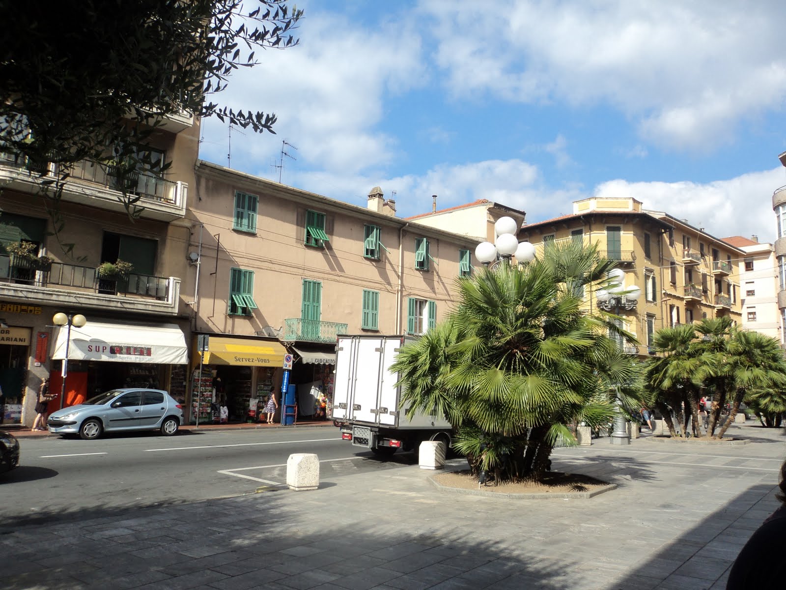
I ride to San Remo via the SP1 and it is a direct route and flat - just what I am looking for at this point. Once I enter San Remo I decide to stop for a caffe, after all I am in Italy. As expected it is much better than across the border in France and cheaper too.


Now its time to find the entrance to the Poggio. I know the route takes the cyclists along the SP1 and then a side street to the Poggio, it turns out I have no problem at all finding it and am ready to tackle the famous hill, or speed bump before the finish depending on how you look at it.

The hill is not steep, quite gradual and not very high either. I guess it makes a difference if it comes after almost 250k of racing!!
Nonetheless, it is a cool climb through a small neighbourhood with stone walls lining much of the climb & descent.


The views are pretty average.

So close to the finish, the descent can be a chance to make attacks - very narrow and winding.

Now time to return to the apartment in Nice. The ride through Italy to Ventimiglia and beyond is interesting as the vibe is different than in France. I find a bike shop and stop in and almost buy a souvenir jersey but can't pull the trigger - oh well, there will be more opportunities for that.

The last bit of Italy before the border. I make a wrong turn and instead of taking open roads across the border I end up going though a tunnel almost 1km long with no room for cyclists. I ride the sidewalk but there are muddy sections and lots of leaned over signposts forcing me off my bike every 20m or so. Not too much traffic so I drop down to the road when nobody is coming and sprint until I see a bus coming behind me and get back on the sidewalk. After it goes by I am back down to the road and able to make the exit before any more traffic comes through.

Once I hit the border things are more serene, now its roads I have cycled before in the past few days and I am able to enjoy my way back.

Some pics of the trip back to Nice


The Poggio is the 1st small hill at around km25 and the bigger one near the end is the climbing toward Eze. It is a Category 3 climb about 4km long @3.8% and topping out at 190m


Friday, July 15, 2011

July 15th Contes

Today was a random ride I picked out a while ago with a climb of a modest mountain(?) of 620m

Stats - A category 2 climb - 6.3km @6.6% topping out at 618m

The ride out of Nice was pretty crappy - a lot of industrial type roads & traffic, lots of commuters. Finally hit town of Contes and things start looking up. Turn off the main road and into a small street where the climb starts. This was a short climb but really nice - although the views were less stellar than I have been used to so far on the trip, the road was great. The switchbacks were tightly packed together and the road narrow making a fun climb.

A cross was perched at one of the switchbacks near the top

Most of the pictures were into the rising sun, so not great.


Thursday, July 14, 2011

July 14th Col de Madone

Bastille Day!
I get up early as I know this is going to be a long one. I heard or read somewhere that one of Lance Armstrong's favorite training rides is the Col de Madone and that is where the name of the Trek Madone came from. I figure its a great ride as I can see the profile and it would be cool to do this ride.

The Col de Madone is a challenging ride - a Category 1 climb of 11.4kms @7.7% topping out at 900m. Lots of smaller climbs on this route too - 3 Cat 3's and 2 Cat 5's giving this ride 1260m of elevation gain.

Sun rising over mountains in Nice


Cool rockcut along road


The top of the Col de Madone in the clouds


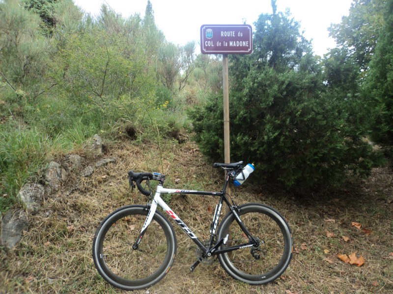
On the right track. It was not easy finding the start point of the route up the Madone. Just a tiny little sidestreet off a secondary road that runs parallel to the sea. There was a placard on a stone wall - can't remember exactly but something about the Corniche du Madone or something. The road went straight up so I thought this might be right. Eventually I came across the sign below and all was good.

The commune of Saint Agnes looks like a cool place to visit but it was early and I was on the clock.

Some steep pitches on the route.

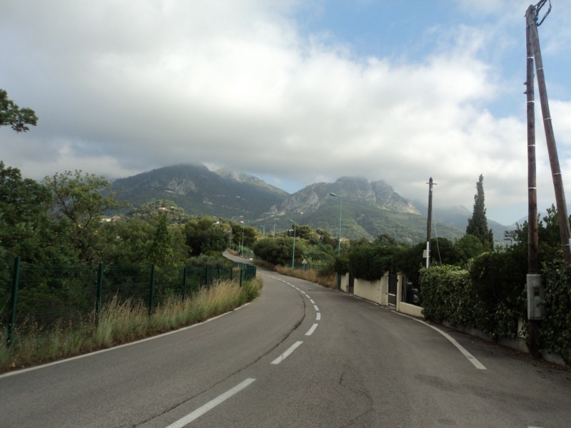
A shot of some of the road going up. Getting pretty cool up here.


Over the top of the mountain and now down the back. A view of the valley below


Descending some of these roads is great. Not too steep at this point - just my cup of tea.


The ride back is pretty great too. Descending down to La Turbie and then I got a little mixed up as I ended up going back to Nice via the same route as yesterday after the Col de Eze. I passed an older French guy, he got on my wheel then we were back and forth in front of each other the rest of the way to Nice. This time I asked him how to get to the Promenade des Anglais as it is close to the apartment and a good reference point and instead of having to find my way through town again, he just told me to follow. Perfect!

Wednesday, July 13, 2011

July 13th Col de Eze

Returned yesterday from Bourg d'Oisans and L'etape. Tired body, tired legs. Still want to ride so I dig up the shortest ride plan I have and decide to ride up to Eze and then up the Col de Eze.

This was an awesome ride - my first ride in Nice was through town and due north through a rural area and up Mt Chauve. This time I took it east and along the coast but up in the hills. Just a great, beautiful ride. The first few kms are flat and then boom, 2km at around 6.5% to climb out of town.

After passing through some cool rock tunnels we get a great view of Villefranche from high in the hills. Very typical of the scenery heading east to Monaco and beyond over the next few days.


Before I know it I am in Eze after less than an hour of steady gradual climbing usually around a 5% grade. Great stuff - not too hard so you are suffering and you can enjoy the effort and take in all the views. One of the most enjoyable cycling experiences was cycling through a small town and suddenly riding through the fantastic smell of freshly baked bread and pastry. There were many many times I would smell the boulangerie before I saw it. It is still early in the morning so I decide to ride up to the old castle up on the hill - crazy steep here - and walk through the passageways and try to get some good pictures. There is a guy hosing down the cobbles and I ask him where I can take some pictures so he just tells me to go into the restaurant and to the terrace as nobody is around.

Here is what Eze looks like from afar.

After leaving the castle, I get on my bike and climb the rest of the way to the top of the Col de Eze. Not long but there is a kilometer in there at 9% that is a real grind.
Overall the climb to the Col de Eze is a Category 2 climb - 7km @ 4.8% peaking at 520m

The return to Nice is brilliant, taking me over different roads back with the first 8km all downhill coasting or soft pedaling. No work at all, just looking around at the spectacular views. The last run-in to the apartment is a little frustrating as I get off course and lost. Its all flat though so I ride around and make my way to the sea from where its easy to find my way home.

Monday, July 11, 2011

July 11th L'Etape du Tour

A few months after planning our trip to France which had to be done far in advance in order to use air miles the 2011 route for the Tour de France was announced. A friend of a friend had done L'etape in 2010 and when the 2011 route was announced I started to think about the possibility of doing L'etape. Rumors were swirling that there would be 2 put on in 2011 and that one of them would include the legendary Alpe d'Huez mountain stage. When the route and date was announced it turned out to be favorable with our travel dates. I registered and started to worry what climbing real mountains would be like. Cycling at home includes lots of short & steep pitches but really nothing that will take more than 5 minutes to climb. What would it be like climbing one of these hills not for 5 minutes but for an hour or longer with no respite???


We start with the Category 1 Col du Telegraphe.
Stats : 12.3kms at 6.9% topping out at 1580m
I know to take it easy. Its early. Real early. This comes after the first 15 or so kms out of Modane that were generally downhill and exhilarating. Just my type of descent - not too steep, just a 2-4% or so gradual descent with some swooping turns. There was a span of 10kms that took only about 12 and a half minutes!


A shot of the guys behind me
Navigating a switchback

Now onto the Galibier! 18km @ 6.6% topping out at 2645m
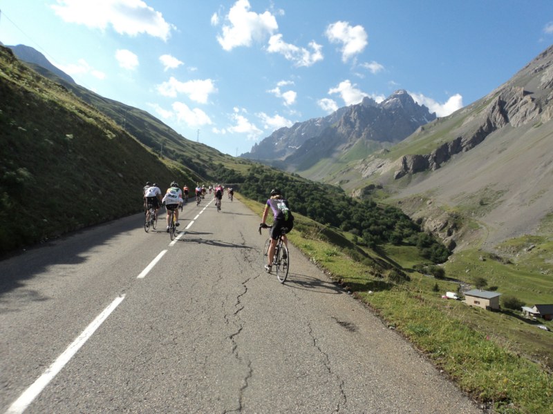
Leaving the ski village there is a long straight that is the deadliest false flat I have ever ridden. Somehow it looks flat but is about a 4+% grade!! I was working hard & going slow like everyone else but no matter what angle I looked at it from it appeared flat.


I was in this race for the experience, the chance to climb some of the epic mountains of the Tour de France and wasn't concrened about how long it was going to take. I was going to go easy, enjoy the views and wait until the bottom of Alpe d'Huez and hammer from there. Lots of chances for photo ops.


Its magical looking back at the road you have covered that is snaking down the mountain with cyclists in an infinite line


Now we are making some progress - that's a long way down where we came from

Another break just before the summit. The road is steep here.

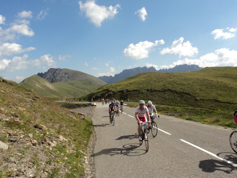
Incredible views.


I had to stop for this shot. A spectacular day with great weather. About two days later it would get as low as 3 degrees and snow would fall putting Stage 18 of the Tour in doubt.


A terrifying descent for me. My home territory is totally flat with small hills that are generally straight line and you never have to worry about navigating any downhill turns. But here? Oh man. Riding the brakes down the mountain pretty much the whole time is tiring. I had to stop and give my forearms and neck a break as they are straining all the way down.
Leaving the Galibier and onto Alpe D'Huez. Time to take things serious - no more photo stops. I finally go into the red as I am all alone and a big group is ahead on the run-in to Bourg D'Oisans. I bridge after about 5mins in the red zone but am rewarded with a spot in a big pack to take me to the base of the last mountain. This stretch is great but the tunnels scare me to death. My first experience with them and its not pleasant. Flying down the road at 40+kph and all of the sudden you are thrown into darkness where you cannot see the road and can only barely see the cyclists beside and in front of you. After a couple of these I remove my sunglasses for the rest of the tunnels as that at least allows me to make out some of the road in front of me. Glad when they are done!


No pictures on the way up Alpe d'Huez.
13.2km @8.3% topping out at 1834m
I make the climb in 66+minutes, pretty happy with my time
Overall my time was in the top 31% but for the ascent up Alpe d'Huez I made the top 4%

After resting up and some chow at the top its time to come down as others are still making their way up. Some walking, some sitting, just barley moving forward. I come across a big group waiting to get water and even sprayed down with hoses. Its carnage out on the slopes of the mountain. Soon after I meet up with the broom wagon making its way up!


The scene post race at the top. A little cool and quite windy. I was eager to make my way down


A view to the valley below as I start my descent.
L'etape was an incredible experience. Physically it is challenging but enjoyable. The things I will remember most are the spectacular views and the hard ride up Alpe d'Huez passing people left & right and the silence during the climb. Everyone in their own pain cave, no energy to be wasted talking, hearing only the heavy breathing going up the mountain. I was fortunate to have good weather, no mechanicals or crashes and make it safely to the finish. Most importantly a supportive family that got dragged around France spending close to 20hours in a car over 3 days with no complaining!!!!


Stats:
Col du Telegraphe - Category 1 - 12km @6.2% topping out at 1566m
Col du Galibier - Hors catégorie - 18km @6.9% topping out at 2645m
Alpe d'Huez - Hors catégorie - 13.2km @8.1% topping out at 1815m